Kerala on red alert amid ‘cyclonic circulation’; monsoon advances into Maharashtra, Delhi next?
Kerala on Red Alert Amid Cyclonic Circulation as Monsoon Advances Toward Delhi and Maharashtra Monsoon Progress and Regional Vulnerabilities Kerala on red
Kerala on Red Alert Amid Cyclonic Circulation as Monsoon Advances Toward Delhi and Maharashtra
Monsoon Progress and Regional Vulnerabilities
Theindiapostdaily.com – Kerala is currently under a red alert due to the intensifying cyclonic circulation in the region, which has triggered heavy rainfall and disrupted normal weather patterns. This critical weather situation has drawn attention to the state’s preparedness as the southwest monsoon makes its way toward Maharashtra and is expected to reach Delhi in the coming days. The India Meteorological Department (IMD) has issued warnings for these areas, emphasizing the potential for extreme weather events that could impact both urban and rural populations.
The monsoon’s arrival in Maharashtra marks a significant shift in the climate dynamics of western India, with heavy downpours likely to persist in the region. Meanwhile, the advance of the monsoon into Delhi is anticipated by the end of June, raising concerns about the city’s readiness for the seasonal rains. This progression underscores the interconnected nature of weather systems across the country, as cyclonic activity in Kerala influences the broader monsoon pattern.
Impact of Cyclonic Circulation on Kerala
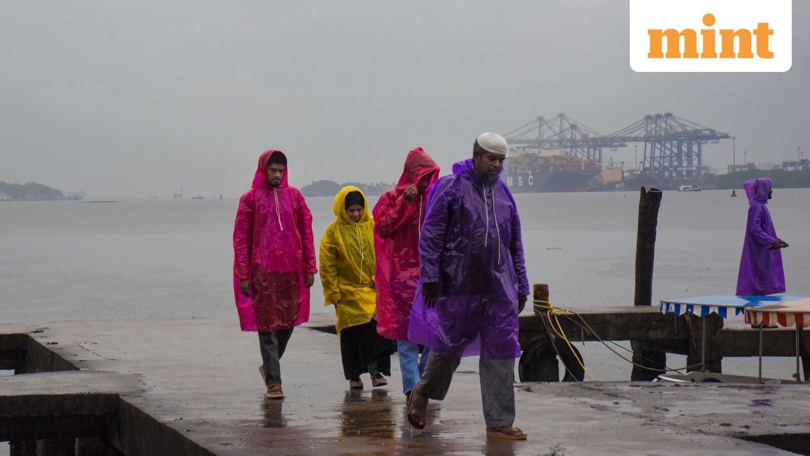
The cyclonic circulation over northern Kerala has become a focal point for meteorological analysis, with its effects intensifying in the last few days. The state’s six districts—Kasaragod, Kannur, Kozhikode, Wayanad, Malappuram, and Idukki—have been placed under a red alert due to the risk of flash floods and landslides. Recent reports highlight that heavy rains have already caused localized damage, including the uprooting of trees and the collapse of infrastructure.
“A tree fell on a temporary shed in Thrissur’s Manaloor area, destroying it and killing a 29-year-old man who was sleeping inside,” reported news agency PTI. This incident exemplifies the severity of the current weather conditions, which have prompted authorities to issue evacuation advisories and deploy emergency response teams in affected regions.
Additionally, the cyclonic circulation is expected to bring heavy to very intense rainfall to Mahe and parts of Kerala from June 6 to June 9. These conditions could further strain drainage systems and increase the risk of waterlogging in low-lying areas. The IMD has warned that the persistent downpours may lead to widespread disruption, particularly in the coastal districts where the impact of the monsoon is most pronounced.
Monsoon Trends and Extended Forecast
As the monsoon advances, the IMD has outlined an extended rainfall outlook that includes multiple regions across northern, central, and western India. From June 7 onward, thunderstorms and lightning are expected to accompany the rain, with strong gusts of wind reported in several states. This trend suggests that the weather system will remain active for the next few weeks, potentially affecting agricultural activities and daily life in various parts of the country.
Scattered to widespread rainfall is projected in Konkan and Goa through June 12, with heavy downpours likely until June 10. Thunderstorms paired with winds up to 60 kmph may also impact Madhya Maharashtra and Marathawada during this period. In north India, regions such as Jammu & Kashmir, Ladakh, Himachal Pradesh, and Uttarakhand are anticipated to see scattered rain, while Haryana, Delhi, Punjab, Rajasthan, and parts of Uttar Pradesh will remain under active weather monitoring.
Delhi’s Monsoon Onset and Preparedness Measures
Delhi is set to witness the monsoon’s arrival by the end of June, with the IMD predicting the onset in the National Capital Region (NCR) between June 25 and June 30. This timeline aligns with the usual monsoon season, but the early advance has raised questions about the accuracy of traditional weather forecasts. Local authorities are preparing for the possibility of sudden rain showers, which could overwhelm drainage systems and lead to urban flooding.
For Sunday, the IMD forecasts partial cloud cover with potential thunderstorms and light rain. While the peak temperature is expected to remain around 36°C, the minimum temperature in Safdarjung has been recorded at 26.4°C, slightly below the historical average. These conditions highlight the variability of the monsoon’s arrival, which could have cascading effects on water resources and power supply in the region.
Broader Implications of the Monsoon Advance
The monsoon’s movement into Maharashtra and Delhi has far-reaching implications, particularly for agriculture and water management. Early rains could help replenish reservoirs and support crop growth, but they also pose challenges such as soil erosion and crop damage in areas unprepared for sudden deluges. In Kerala, the focus remains on mitigating the risks associated with the cyclonic circulation, which has already caused at least one fatality and disrupted transportation networks.
As the weather systems evolve, the IMD continues to monitor their interactions closely. The presence of a cyclonic circulation in Kerala, combined with the advancing monsoon, may create conditions for prolonged rainfall and increased humidity in the western and central regions. This situation requires coordinated efforts from state governments and local agencies to ensure timely response and minimize the impact on communities.